
www.lowermanhattan.info
A Quick History of the Governors Island
The 172-acre island is just a few hundred yards away from the Financial District of Manhattan, in the middle of New York Harbor. The island is part of Manhattan as it shares the same zip code as the Battery (10004).

The island originally served a Dutch trading post in the 1600's and was home to a mill and just a few settlers homes. In 1800 it was sold to the government for $1. Just six years earlier in 1794, it began its transformation into New York's commanding headquarters and military post for the United State Army. During the war of 1812, it played an important role in protecting New York City from naval attacks from the British. It also played as an integral part in a larger coastal defense network during other wars such as the Civil War, World War II and the beginning of the Cold War. It was occupied by the U.S. army until 1966 when it was handed over to the U.S. Coast Guard. Civilians were not allowed to live on the island, only stationed army or coast guard personnel and their families could live on the island.
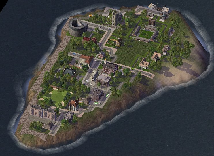
The Coast Guard left in 1997 and until 2003 Governors Island lay entirely abandoned and dormant, eerily similar to a ghost town. Though, in 2003 the island was returned to the city by the government and designated a historical monument, the National Park Service has been hosting tours of the island to visitors since then. We'll start our tour at the historical northern part of the island.
Soissons Dock, Governors Island Ferry Dock
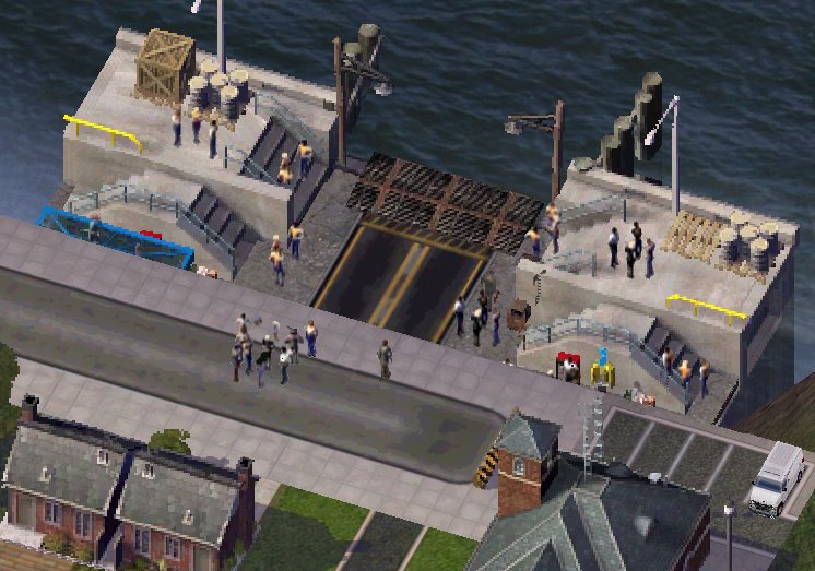
Ferry is the only way to get to and from the island. The ferry leaves from the Battery Marine Terminal, next to the Staten Island Ferry Terminal. Currently the only people who live on the island are the ferry operators who rotate one-week shifts staying on the island. The structures in the photo below on the left are buildings used by the New York/National Park Service which owns the island and the building to the right serves as a gift shop and security office.
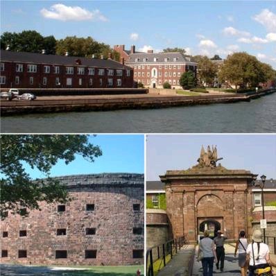
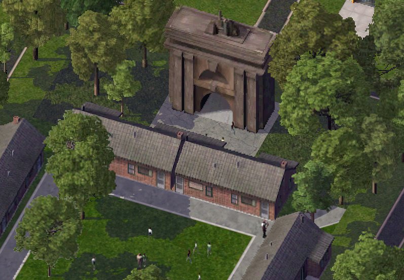
Fort Jay Gate
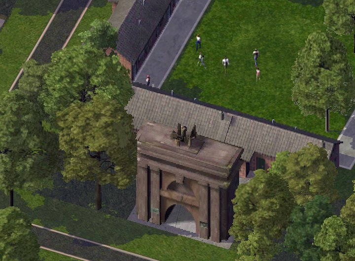
The sandstone gate to Fort Jay is one of Governor Island’s most recognizable landmarks. The sculpture on top of the gate was constructed as a replica of the War Department seal.
Fort Jay
The fort was originally built in 1764 and completed in 1798. George Washington declared Fort Jay "to be the strongest fort in the American colonies" at the start of the American Revolution. It was put on the map when Americans defended the city against the British in the War of 1812. The barracks of Fort Jay date back to 1811 and were used up until 1997 when the Coast Guard left the island. Since the fort was strategically built on the highest point on the island canons can still be found around the Fort guarding New York Bay.
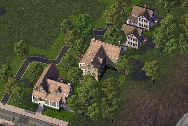
Next up on the tour is the area of Governors Island known as Colonel's Row. The tree-lined streets resemble a quaint New England town. It's easy to see why army officer's picked this area of the island to build housing during the Civil War. Most of the officer’s houses are painted yellow.
Colonel's Row
The Admirals Mansion and Governors Quarters shows reflects the grand architecure of the original officer's housing.
Admirals Mansion with Governors Quarters
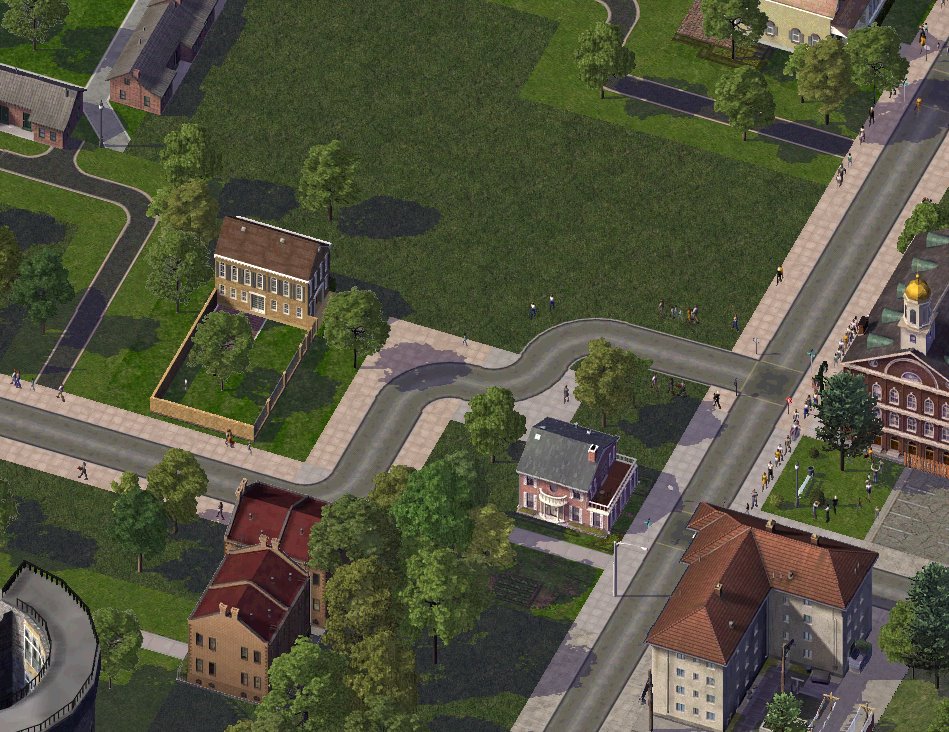
Canons placed in front of the Admirals Mansion

Chapel of Saint Cornelius the Centurion
The chapel is one of three houses of worship on the island and is owned by Trinity Church.

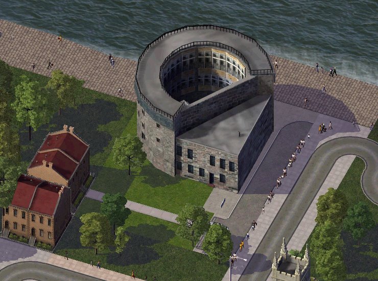
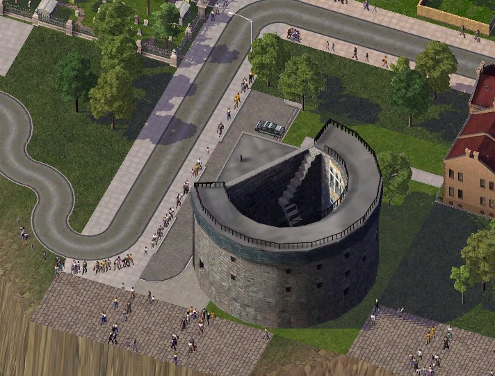
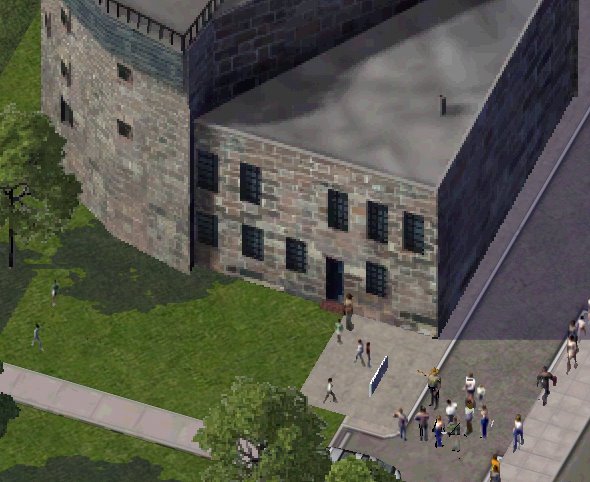
Castle Williams
Castle Williams, which was completed in 1811, is the twin to Castle Clinton in Battery Park. The castle was used as a jail until 1966. Captured confederate soldiers and even Walt Disney during World War II were imprisoned here.
Glass was installed in the 70's to protect the inside of the building from the elements.
Back of Castle Williams.
A tour group lead by a park ranger.
Liggett Hall
Constructed in the 1920's, Liggett Hall is of the fringe of the historical area of Governors Island and served as the main barracks for the army. Interestingly enough, the main reason it was built was to prevent an airport from being constructed on the island.

Public School 26
P.S. 26 is the island's only school. It was built as an elementary school for children of army families.

Moving into the southern part of the island (which was mainly built up in the 1950's-1970's) we come across a strange sight.
Manhattan's one and only golf course.
That's right. A golf course in the borough of Manhattan right here on Governors Island. The real golf course isn't as pristine as its SimCity counterpart due to falling into disrepair for five years but there are talks of repairing it for future use.

Finally we arrive at the residential area where families of army and coast guard personnel lived. The area has many different types of structures that were constructed from the 50's to the late 70's from a Super 8 Motel, to a theater, to a yoga center, to even a Burger King. Some New Yorker's have fond memories growing up on the island as it similar to having a small New England town right in the middle of New York.
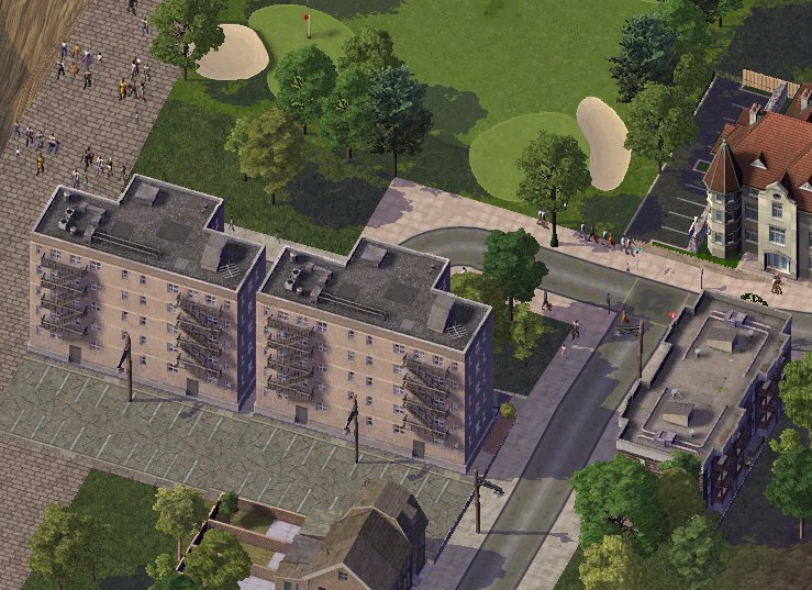
None of these buildings are in operation anymore but the city is deciding what to do with all the structures on this portion of the island. Development on the historical northern portion isn't allowed as it was designated a national historical monument but proposals for the southern part include a casino, an oceanographic center, or a reusing the structures for commercial and residential use. There's even speculation of using the some of the historical buildings on the northern side as a military college. For now the National Park service will continue to give tours of the island to visitors until something is decided upon by the city.
To learn more about Governors Island and see the real world sights on the Island go to Governors Island History and Tour Photos, the National Park Services Governors Island page or Tolerance Park.
That's all for now. Next time we'll venture up to Roosevelt Island, Manhattan's other "unknown" island.
No comments:
Post a Comment