
Saturday, November 04, 2006
Now You can Have a Piece of New York in SimCity Too!
I'm going to release some of my BAT's which I have made for my New York region. I'll put up a download link where you can access BAT's and 3ds models. Stay tuned.


Tuesday, October 31, 2006
Happy Halloween
Halloween, Big Apple style. Trick-or-treaters converge on the streets for Halloween treats as night falls over New York the city comes alive with Halloween activities.
Trick-or-treating on the Upper West Side.

Cavalry Cemetery in Queens, New York seems more eerie on Halloween night.

Trick-or-treating on the Upper West Side.

Cavalry Cemetery in Queens, New York seems more eerie on Halloween night.

Tuesday, October 24, 2006

Tuesday, October 17, 2006
A Trip to Roosevelt Island
 Image from octagonnyc.com
Another one of New York's smaller islands is Roosevelt Island. The Island is located in between Manhattan and Queens in the East River. The only way to get to and from Roosevelt Island is by tram, subway (the F Train) or by the Roosevelt Island Bridge.
Despite its seeming obscurity, Roosevelt Island is a day trip destination in New York for residents and savvy tourists.

The island was named Blackwell Island named after Robert Blackwell, son of British captain John Manning, in 1686. Since then it has been used for a prison, an insane asylum, and two smallpox’s hospital. The island was once again renamed Welfare Island in 1921.

In 1973 it was renamed Roosevelt Island and began its residential re-development with construction of the first apartment complex, Eastwood
The Roosevelt Island Tram
We begin our tour in Manhattan at The Roosevelt Island Tram station at 59th Street and 2nd Avenue. The Roosevelt Island Tramway began operating in to serve as temporary means of transit to and from the island during the construction of the Roosevelt Island subway stop on the F train (which when completed in 1989 was thirteen years late).
Though, it quickly became a unique mode of transportation and developed into the very icon of Roosevelt Island. It's appeared many times on the big screen, most recently in the 2002 movie Spiderman. In 1984, the Roosevelt Island Operating Corporation (RIOC) was created incorporating the tramway and bus service as part of its transit service plans.

As the tramcar silently glides toward Roosevelt Island it offers breath-taking views of the east side of Manhattan and the city during the ride.
 Even though it may seem dangerous to travel via tramway, which is suspended 250 feet over the river, there have been only 2 safety scares.
One in 1998 when a crane working on the Queensboro Bridge hit a passing tram car and another one just this year in April when both the inbound and outbound tram cars stalled for hours over the East River leaving a total of 68 people stranded with no way out. After passenger's realized they were not in any immediate danger they passed the hours it would take rescue crews to reach them by telling stories, jokes, talking with relatives on cell phones and even signing songs in one car.
That incident put the tram out of service from April 19th to Sep 1st while officials tested the tramway for any safety hazards. It has been running smoothly since then.
Ride the tram and see the views.

A few minutes later the tram arrives at the Roosevelt Island Tram Terminal.

All the buses owned and operated by the RIOC are painted red, which has lead to them simply being called Red Bus. Currently, the RIOC is updating the buses to run on hybrid electric power. Fare is only 25 cents and is free for students.

Southtown Development
The latest housing development, Southtown (currently rising on the southern portion of the island) broke ground in 2001. 2,000 new units are expected to be completed, one of the largest residential development projects in recent New York history. The building's are more attractive than the other housing on the island from the mid 70's. They offer spectacular views of Manhattan, a just steps away from the river and minutes from Midtown. In addition, the area will be landscaped with tranquil parks, softball and soccer fields. Take a vitrual tour of a typical Southtown apartment. (Requires Quicktime)

The other apartments on the island which were built in the 70's are very blocky, bulky, and cold. The stores on the bottom are all uniform in appearance and even signage. The brutalist style makes for an odd walk down Main Street. The SimCity buildings used as the apartments look nicer than their real world counterparts.

Renwick Ruins
The former Blackwell Island Smallpox Hospital (now known as Renwick Ruins) was built in 1856 on the Southern tip of the island. James Renwick, architect of St. Patrick's Cathedral, designed it. It was used a smallpox hospital until 1875 when it was converted into a city hospital, though it was abandoned in the 50's. Now a chain link fence surrounding the property and it is illegal to trespass on the site due to concerns about the structural soundness of the structure. Though, urban explorer's still trespass looking for thrills and chills.

Renwick Ruins lit up at night by spotlights.

Blackwell Farmhouse
The Blackwell family farmhouse is the oldest building on Roosevelt Island dating back to 1796 and sits on its original site. Today, it serves as a community center even though it is under going more restoration and repair.

FDNY Special Operations Command
Roosevelt Island is also home to one of the FDNY's special command centers. Outside a reserve fire engine and a marine unit wait for duty.

The Chapel of the Good Shepherd
Built between 1816-1896 the Chapel of the Good Shepherd was recently restored and rededicated by the city. It is the oldest church on the island.

Main Street
Roosevelt Island’s main thoroughfare is host to many shop's, restaurant’s and other services for residents. Motorgate is just barely visible on the left side of the picture.

Roosevelt Island Bridge
Also known as Welfare Island Bridge opened in 1955 connects the island to Queens and lifts to allow boats to pass under. It is the only way for cars to get on the island.

Another historical house. A home dating back to the Revolutionary War era.

The Octagon
Located at the northern end of Roosevelt Island
The Octagon has a long and colorful history. It served as a pavilion for the city's lunatic asylum, which opened in 1839 (the rest of the U-shaped complex was demolished in the 70's).
In 1894, due to over crowding in the asylum patients were moved to a bigger facility on Ward's Island. The former asylum was turned into a city hospital until it was shut down in the 1950's (many of the building's on the island were abandoned for larger spaces in Manhattan).
Lying dormant and unused for three decades the Octagon fell into disrepair and suffered two fires throughout the 90's, which destroyed the dome, which crowned the structure.
Now the landmark the Octagon is being restored and rehabilitated by developer Bruce Becker as a luxury waterfront apartment complex, which will include an outdoor pool, tennis courts and a fitness center. You can learn more about the project at dexigner.com
Finally, some of you will notice The Octagon in the screenshot is represented by Radcliffe Camera at Oxford University (model created by Caliban), it's not a perfect match but it is similar, yet more beautiful than The Octagon. You can download it here.

The Roosevelt Island Lighthouse
Our last stop on our tour of Roosevelt Island is The Roosevelt Island Lighthouse . The small lighthouse's was constructed in 1872 designed by James Renwick, Jr. It is rumored that a patient of the asylum is to have assisted in the construction of the lighthouse and even scrawled an ominous warning to visitors on a plaque. Though, the plaque was stolen in the 60's and it is questionable a patient of the asylum would have assisted with the construction of much of anything.
Nonetheless, today it is still used today to guide boats along the East River and is a unique landmark on the oasis in the middle of New York City that is Roosevelt Island.

That's it for our tour of Roosevelt Island if you'd like to learn more about Roosevelt Island or just want to see more pictures you can visit the links below:
Roosevelt Island Historical Society
Forgotten New York's Tour of Roosevelt Island
Roosevelt Island Timeline
Manhattan in the Making: Downtown Development

Lower Manhattan is continuing to develop. Below is a shot of the rising skyline with 88 Pine Street, the Trump Building, and the Banker's Trust Building.
The Trump Building is a sketchup model, which was downloaded from Google's 3D Warehouse for Google Earth and is a rough draft so far. Eventually the model will get finished once it's edited to SC4 standards.

Wednesday, October 11, 2006
Small Plane Crashes into Apartment Building on Upper East Side
upper
A small plane crashed into 20th floor of a 50 story apartment building located at 524 E. 72nd Street shortly before 3 p.m. this afternoon. It was piloted by New York Yankees pitcher Cory Lidle, who was one of two people killed in the accident. No one on the ground or in the apartment building were seriously injured. From NY1,
"New York Yankees pitcher Cory Lidle was one of two people killed when a small plane crashed into a 50-story high-rise on Manhattan’s Upper East Side Wednesday afternoon, temporarily igniting fears of terrorism and prompting a massive emergency response."
Immediately following the accident, fears of terrorism were ignited and prompted a massive emergency response within the city by the FDNY and NYPD. Even Mayor Bloomberg rushed to the scene to survey the damage. The nation's defense system's also responded swiftly not wanting to take any chances in a post 9/11 era, NOAA and the Department of Homeland Security scrambled to assemble fighter jets to protect the skies as a precautionary measure.
Some witnesses say the airplane appeared to be having "mechanical problems" while others are saying "it circled the area" before crashing into the apartment building. The NTSB and FAA are still investigating the cause of the crash. More from NY1.com
Tuesday, October 10, 2006
NYCJ Research & Development: Going Up
There has been a flurry of activity in the past month or so behind the scenes of the project; designing new banners/graphics for this blog, BATting and working within the region. Lately most of my activities have been focused on BATting. With the discovery of a free 3D model download site housing a vast amount of gmax models and the ability to use models from greatbuildings.com I have been able to expedite the process of creating buildings so they can get into the region more quickly. Here's just a few I'm currently working on,
Yankee Stadium

Citigroup(Citicorp)Center

1 and 2 United Nations Plaza

Stay tuned for more.
Yankee Stadium

Citigroup(Citicorp)Center

1 and 2 United Nations Plaza

Stay tuned for more.
Sunday, September 17, 2006
NYCJ Research & Development: The Millenium Hilton Hotel

The Millennium Hilton Hotel completed in 1992. 59 stories tall at 142 meters (467 feet) tall, located at Church Street and Vessey Street. 75% Completed.
Monday, September 11, 2006
Rembering 9/11: Five Years Later

Dedicated to the World Trade Center, the victims of 9/11 and their families.
Today marks the passing of the fifth year since the World Trade Center attacks. It is a time for looking back while looking forward. Below are a few images from the day that changed everything and everyone.

8:49 a.m. Times Square in comes to a halt.
A crowd gathers around the Pansonic Jumbo-Tron in Times Square while motorist crawl by; gawking up in disbelief at the unfolding events.

8:51 a.m. Firefighters and police begin to arrive on the scene. NYPD Transit Officer Mike Sullivan directs workers out of the South Tower while looking up for falling debris, instructing them to "get out of the area."

9:59 a.m. The unimaginable happens with the collapse of the South Tower.

10:12 a.m. Choking smoke quickly engulfs Lower Manhattan due to the collapse of the South Tower, police officers, firefighters and on lookers flee the area.
 The Tribute in lights makes it's frist appearance on the first anniversary of 9/11.

Tuesday, September 05, 2006
New York in the Making: Brooklyn Brownstones
After a bit of an absence I'm back with a quick update.
Brownstones are ubiquitous all over New York so it would only seem appropriate to include them on my BAT "to-do" list. I found some free time recently to make some brownstones in Brooklyn. These are screenshots from BAT, the buildings look much better once they're rendered.


Be on the look out for them a future Brooklyn update, in the meantime the CJ will return later this week with the Roosevelt Island update. (Finally)
Saturday, August 19, 2006
Privacy Policy
I respect your privacy and I will ensure your privacy online while visiting nycj.blogspot.com. The following discloses the information gathering and dissemination practices for this blog.
Log Files
Like most standard Web site servers I use log files. This includes internet protocol (IP) addresses, browser type, internet service provider (ISP), referring/exit pages, platform type, date/time stamp, and number of clicks to analyze trends, administer the site, track user’s movement in the aggregate, and gather broad demographic information for aggregate use. IP addresses, etc. are not linked to personally identifiable information.
Cookies
A cookie is a piece of data stored on the user’s computer tied to information about the user. Our site don’t use cookies. However, Some of my partners use cookies on this blog (for example, advertisers). However, I have no access to or control over these cookies, once I have given permission for them to set cookies for advertising. If you wish to disable cookies, you may do so through your individual browser options.
Third Party Links
This Web site contains links to other sites. Please be aware that I am not responsible for the privacy practices of such other sites. I encourage my users to be aware when they leave this blog and to read the privacy statements of each and every Web site that collects personally identifiable information. This privacy statement applies solely to information collected by this blog.
Advertisers
I use outside ad companies to display ads on this blog. These ads may contain cookies and/or web beacons to collect data in the ad serving process and are collected by our ad companies, and I do not have access to this information. For further information, consult the privacy policy of Google Adsense.
Contact Information
If users have any questions or suggestions regarding your privacy policy, please contact me at: ehanson@mail.com.
Ensure your internet security settings are at the optimum level for your safe browsing. Read how manage your cookies at surfsafely.com.
Log Files
Like most standard Web site servers I use log files. This includes internet protocol (IP) addresses, browser type, internet service provider (ISP), referring/exit pages, platform type, date/time stamp, and number of clicks to analyze trends, administer the site, track user’s movement in the aggregate, and gather broad demographic information for aggregate use. IP addresses, etc. are not linked to personally identifiable information.
Cookies
A cookie is a piece of data stored on the user’s computer tied to information about the user. Our site don’t use cookies. However, Some of my partners use cookies on this blog (for example, advertisers). However, I have no access to or control over these cookies, once I have given permission for them to set cookies for advertising. If you wish to disable cookies, you may do so through your individual browser options.
- Google, as a third party vendor, uses cookies to serve ads on your site.
- Google's use of the DART cookie enables it to serve ads to your users based on their visit to your sites and other sites on the Internet.
- Users may opt out of the use of the DART cookie by visiting the Google ad and content network privacy policy.
Third Party Links
This Web site contains links to other sites. Please be aware that I am not responsible for the privacy practices of such other sites. I encourage my users to be aware when they leave this blog and to read the privacy statements of each and every Web site that collects personally identifiable information. This privacy statement applies solely to information collected by this blog.
Advertisers
I use outside ad companies to display ads on this blog. These ads may contain cookies and/or web beacons to collect data in the ad serving process and are collected by our ad companies, and I do not have access to this information. For further information, consult the privacy policy of Google Adsense.
Contact Information
If users have any questions or suggestions regarding your privacy policy, please contact me at: ehanson@mail.com.
Ensure your internet security settings are at the optimum level for your safe browsing. Read how manage your cookies at surfsafely.com.
Saturday, August 12, 2006
NYPD Monitors Chemicals in Wake of Terror Plot
The NYPD has begun to closely monitor the purchase of chemicals like the ones used in the plot to blow up ten American bound planes en route from London. The NYPD is re-instating its five-year-old operation Nexus tactical program.
Police are asking chemical suppliers to report any suspicious orders.
Police are asking chemical suppliers to report any suspicious orders.
Friday, August 04, 2006
Manhattan in the Making: BAT's Under Construction
Just a quick update on the development of the project.
Part of the fun which comes in recreating New York is creating custom content for the map. BAT's play the main role in this project because without them New York isn't New York. Currently, I'm nearing completion on one of the BAT's I'm working on, Trinity Church. (The other two BAT's I'm currently working on are the Carnegie Deli and Park Avenue Tower) This is the first church I've batted of this scale and detail level and while it may not be like Caliban's awe inspiring churches I think I've done a pretty good job.

The steeple looks a little squashed due to the perspective of the game, but the building is accurately scaled to 85 meters. There's still a little more work to done such finishing up the rear, adding a few details to the steeple and nightlighting before it's ready for rendering and lot making. After that it will be placed at the end of Wall Street.
Be on the look out for it in a development shot of the Financial District.
Wednesday, August 02, 2006
Heatwave Causes Casuing Scattered Outages All over City
With temperatures in the triple digits and demand on the power grid being put to its limits, the city is experiencing scattered power outages. Con Ed are working to restore power to the affected areas. Areas such as Sunset Park and Ozone Park lost power yesterday night.
"It was just a big ‘kaboom!’ Everybody heard. The car alarms just went off and all the lights went off completely," said Crystal Mendez who lost power.
Landmarks around the city are doing their part to conserve energy during the heatwave.
At Yankee Stadium, the Diamondvision Screen was turned off landmarks such as the Empire State and Chrysler Buildings shut off the spotlights on their spires and all the East River Bridges spotlights went dark as well.
To see a list of ways to stay safe during the heatwave see The NYC Office of Emergency Management has some tips on how to beat the heat at NY1.com.
Tuesday, August 01, 2006
Heatwave Prompts Heat Emergency

With temperatures going past the 100 degree mark and the power grid problems of last week Mayor Bloomberg issued a heat emergency for the city this morning,
"This is a very serious, dangerous heat wave and we're all tough, but a little bit of common sense and a little bit of cooperation will go a long way here," said Mayor Bloomberg. "Remember that thousands of other people will be flicking switches and reaching for remotes at the same time that you are, and you really could strain the power grid.”
The city's power usage reached an all time high today at 5 p.m. The mayor is asking everyone to due their part to conserve power by running air conditioning at 78 degrees,turning them on air conditioners only when at home and by using heavy appliances only during early morning or late at night.
To find out more about the heat wave go to NY1.com.
Sunday, July 30, 2006
A Tour of Governors Island
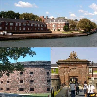
www.lowermanhattan.info
A Quick History of the Governors Island
The 172-acre island is just a few hundred yards away from the Financial District of Manhattan, in the middle of New York Harbor. The island is part of Manhattan as it shares the same zip code as the Battery (10004).

The island originally served a Dutch trading post in the 1600's and was home to a mill and just a few settlers homes. In 1800 it was sold to the government for $1. Just six years earlier in 1794, it began its transformation into New York's commanding headquarters and military post for the United State Army. During the war of 1812, it played an important role in protecting New York City from naval attacks from the British. It also played as an integral part in a larger coastal defense network during other wars such as the Civil War, World War II and the beginning of the Cold War. It was occupied by the U.S. army until 1966 when it was handed over to the U.S. Coast Guard. Civilians were not allowed to live on the island, only stationed army or coast guard personnel and their families could live on the island.
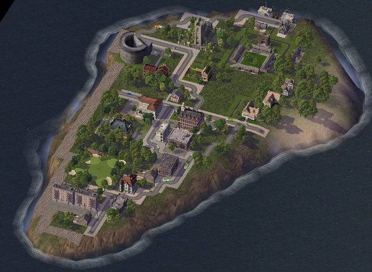
The Coast Guard left in 1997 and until 2003 Governors Island lay entirely abandoned and dormant, eerily similar to a ghost town. Though, in 2003 the island was returned to the city by the government and designated a historical monument, the National Park Service has been hosting tours of the island to visitors since then. We'll start our tour at the historical northern part of the island.
Soissons Dock, Governors Island Ferry Dock
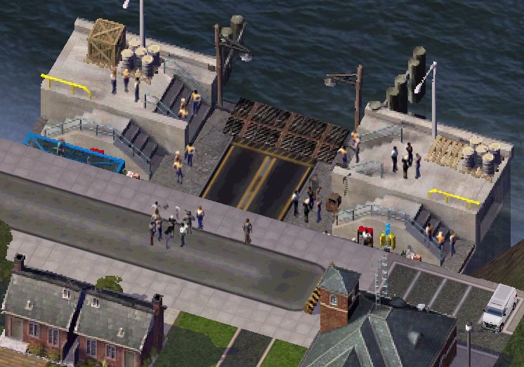
Ferry is the only way to get to and from the island. The ferry leaves from the Battery Marine Terminal, next to the Staten Island Ferry Terminal. Currently the only people who live on the island are the ferry operators who rotate one-week shifts staying on the island. The structures in the photo below on the left are buildings used by the New York/National Park Service which owns the island and the building to the right serves as a gift shop and security office.
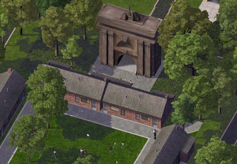
Fort Jay Gate
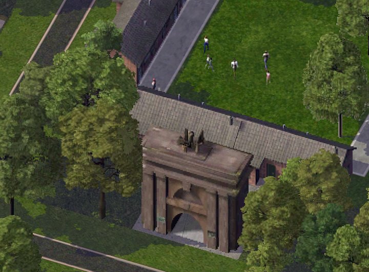
The sandstone gate to Fort Jay is one of Governor Island’s most recognizable landmarks. The sculpture on top of the gate was constructed as a replica of the War Department seal.
Fort Jay
The fort was originally built in 1764 and completed in 1798. George Washington declared Fort Jay "to be the strongest fort in the American colonies" at the start of the American Revolution. It was put on the map when Americans defended the city against the British in the War of 1812. The barracks of Fort Jay date back to 1811 and were used up until 1997 when the Coast Guard left the island. Since the fort was strategically built on the highest point on the island canons can still be found around the Fort guarding New York Bay.
Next up on the tour is the area of Governors Island known as Colonel's Row. The tree-lined streets resemble a quaint New England town. It's easy to see why army officer's picked this area of the island to build housing during the Civil War. Most of the officer’s houses are painted yellow.
Colonel's Row
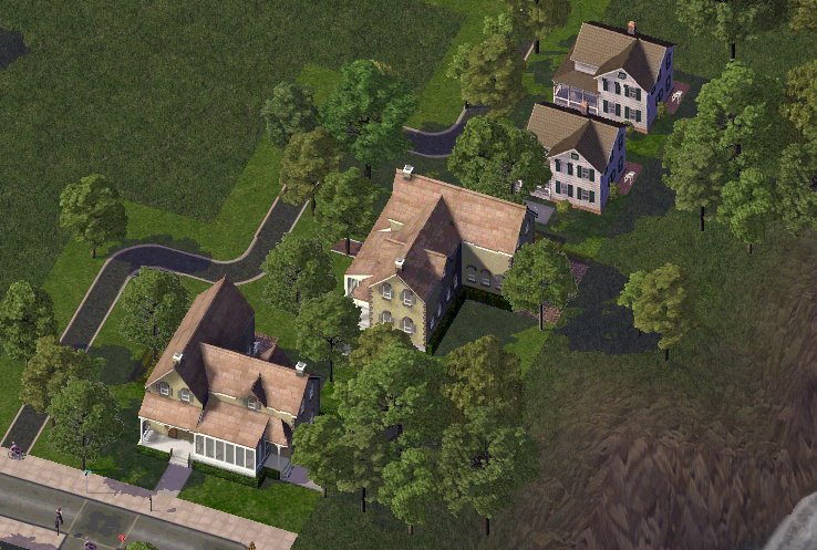
The Admirals Mansion and Governors Quarters shows reflects the grand architecure of the original officer's housing.
Admirals Mansion with Governors Quarters
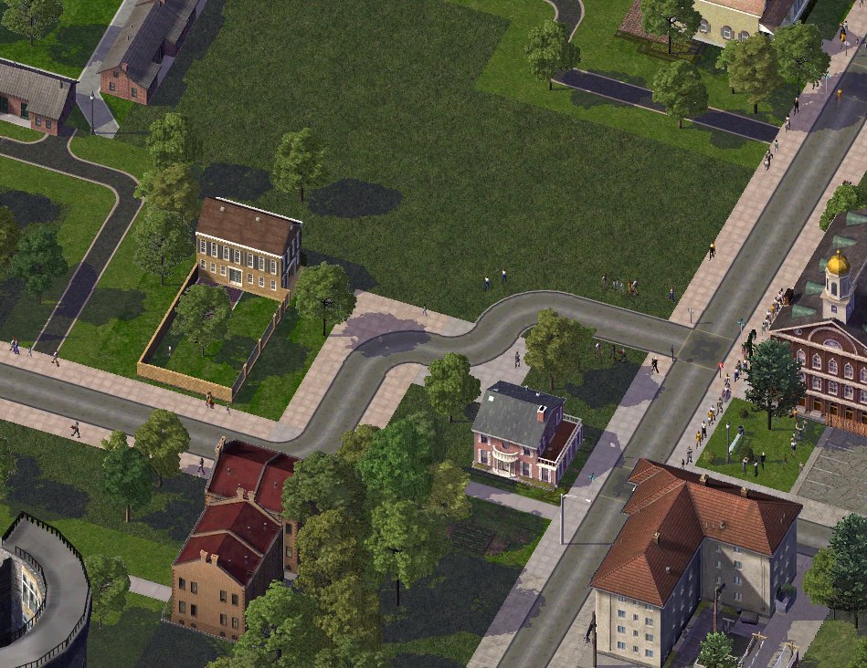
Canons placed in front of the Admirals Mansion

Chapel of Saint Cornelius the Centurion
The chapel is one of three houses of worship on the island and is owned by Trinity Church.

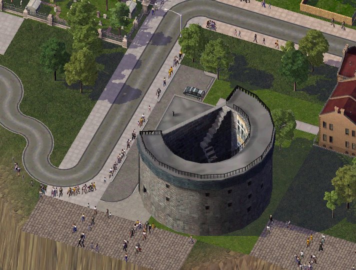
Castle Williams
Castle Williams, which was completed in 1811, is the twin to Castle Clinton in Battery Park. The castle was used as a jail until 1966. Captured confederate soldiers and even Walt Disney during World War II were imprisoned here.
Glass was installed in the 70's to protect the inside of the building from the elements.
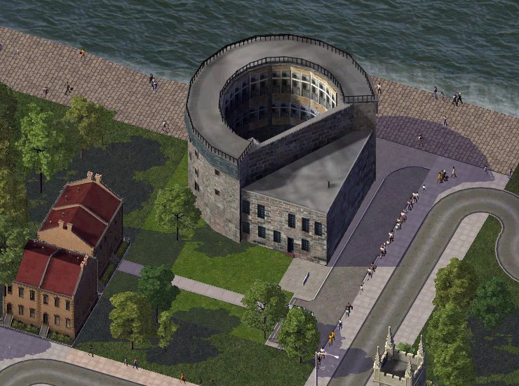
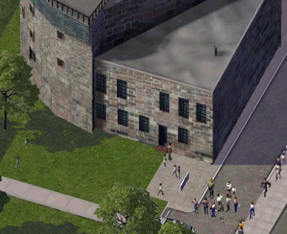
Back of Castle Williams.
A tour group lead by a park ranger.
Liggett Hall
Constructed in the 1920's, Liggett Hall is of the fringe of the historical area of Governors Island and served as the main barracks for the army. Interestingly enough, the main reason it was built was to prevent an airport from being constructed on the island.

Public School 26
P.S. 26 is the island's only school. It was built as an elementary school for children of army families.

Moving into the southern part of the island (which was mainly built up in the 1950's-1970's) we come across a strange sight.
Manhattan's one and only golf course.
That's right. A golf course in the borough of Manhattan right here on Governors Island. The real golf course isn't as pristine as its SimCity counterpart due to falling into disrepair for five years but there are talks of repairing it for future use.

Finally we arrive at the residential area where families of army and coast guard personnel lived. The area has many different types of structures that were constructed from the 50's to the late 70's from a Super 8 Motel, to a theater, to a yoga center, to even a Burger King. Some New Yorker's have fond memories growing up on the island as it similar to having a small New England town right in the middle of New York.
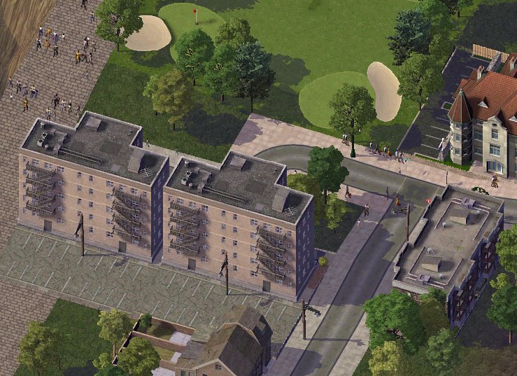
None of these buildings are in operation anymore but the city is deciding what to do with all the structures on this portion of the island. Development on the historical northern portion isn't allowed as it was designated a national historical monument but proposals for the southern part include a casino, an oceanographic center, or a reusing the structures for commercial and residential use. There's even speculation of using the some of the historical buildings on the northern side as a military college. For now the National Park service will continue to give tours of the island to visitors until something is decided upon by the city.
To learn more about Governors Island and see the real world sights on the Island go to Governors Island History and Tour Photos, the National Park Services Governors Island page or Tolerance Park.
That's all for now. Next time we'll venture up to Roosevelt Island, Manhattan's other "unknown" island.
Subscribe to:
Posts (Atom)